File:Rose Wilder Lane gravesite.jpg
From North American Confederacy
Jump to: navigation, search

Size of this preview: 800 × 597 pixels. Other resolution: 320 × 239 pixels.
Original file (2,432 × 1,816 pixels, file size: 1.35 MB, MIME type: image/jpeg)
This file is from Wikimedia Commons and may be used by other projects. The description on its file description page there is shown below.
Summary
DescriptionRose Wilder Lane gravesite.jpg |
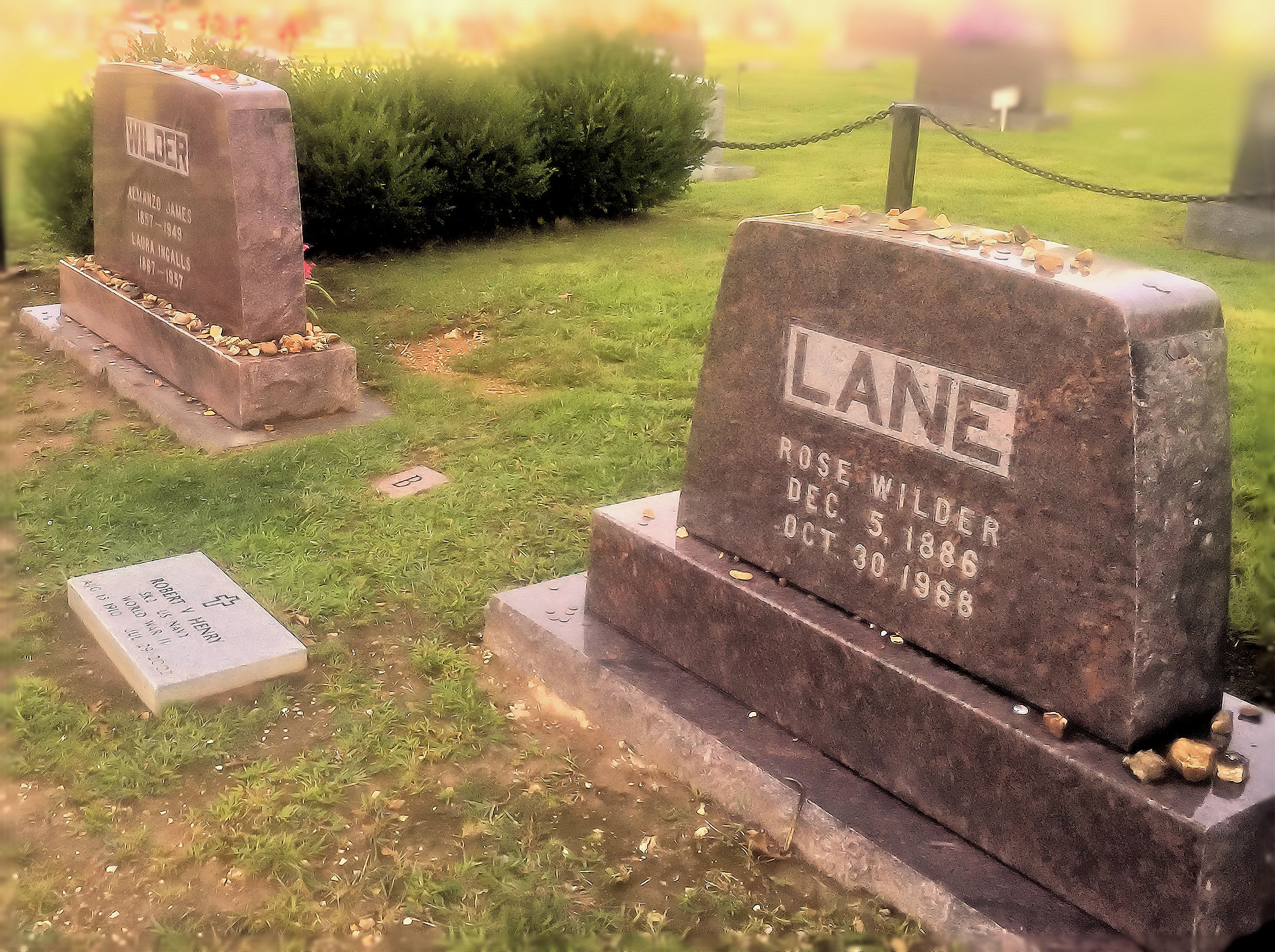
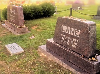
English: Gravesite of Rose Wilder Lane next to parents Almanzo Wilder and Laura Ingalls Wilder, Mansfield Cemetery, Mansfield, MO; taken by Julie Jordan Scott; credited and modified according to Creative Commons Attribution 2.0 Generic (CC BY 2.0) licensing. Obtained from Flickr. |
Date | |
Source | https://www.flickr.com/photos/juliejordanscott/20615786989/ |
Author | Julie Jordan Scott |
Camera location | 37° 06′ 47.69″ N, 92° 35′ 05.17″ W ![]() ![]() | View this and other nearby images on: OpenStreetMap | ![]() |
---|
Licensing
![]() |
This image, originally posted to Flickr, was reviewed on 31 August 2015 by the administrator or reviewer Leoboudv, who confirmed that it was available on Flickr under the stated license on that date. |


This file is licensed under the Creative Commons Attribution 2.0 Generic license.
- You are free:
- to share – to copy, distribute and transmit the work
- to remix – to adapt the work
- Under the following conditions:
- attribution – You must give appropriate credit, provide a link to the license, and indicate if changes were made. You may do so in any reasonable manner, but not in any way that suggests the licensor endorses you or your use.
Captions
Add a one-line explanation of what this file represents
Items portrayed in this file
depicts
some value
37°6'47.68999"N, 92°35'5.16998"W
22 August 2015
0.00154320987654320987 second
2.2
4.15 millimetre
image/jpeg
File history
Click on a date/time to view the file as it appeared at that time.
Date/Time | Thumbnail | Dimensions | User | Comment | |
---|---|---|---|---|---|
current | 16:01, 28 August 2015 | ![]() | 2,432 × 1,816 (1.35 MB) | Winkelvi | User created page with UploadWizard |
File usage
The following page links to this file:
Metadata
This file contains additional information, probably added from the digital camera or scanner used to create or digitize it.
If the file has been modified from its original state, some details may not fully reflect the modified file.
Camera manufacturer | Apple |
---|---|
Camera model | iPhone 6 |
Date and time of data generation | 18:22, 22 August 2015 |
Exposure time | 1/648 sec (0.0015432098765432) |
F Number | f/2.2 |
ISO speed rating | 32 |
Lens focal length | 4.15 mm |
Latitude | 37° 6′ 47.69″ N |
Longitude | 92° 35′ 5.17″ W |
Altitude | 459.931 meters above sea level |
Width | 2,432 px |
Height | 1,816 px |
Horizontal resolution | 72 dpi |
Vertical resolution | 72 dpi |
Orientation | Normal |
File change date and time | 18:22, 22 August 2015 |
Software used | PaintShop Pro 17.00 |
Exif version | 2.21 |
Supported Flashpix version | 0,100 |
Color space | sRGB |
Meaning of each component |
|
Date and time of digitizing | 18:22, 22 August 2015 |
DateTimeOriginal subseconds | 399 |
DateTimeDigitized subseconds | 399 |
Exposure Program | Normal program |
APEX shutter speed | 9.3400464756003 |
APEX aperture | 2.2750071245369 |
APEX brightness | 8.2614047791455 |
APEX exposure bias | 0 |
Metering mode | Spot |
Flash | Flash did not fire, compulsory flash suppression |
Sensing method | One-chip color area sensor |
Scene type | A directly photographed image |
Exposure mode | Auto exposure |
White balance | Auto white balance |
Focal length in 35 mm film | 29 mm |
Scene capture type | Standard |
GPS time (atomic clock) | 23:22 |
Speed unit | Kilometers per hour |
Speed of GPS receiver | 0 |
Reference for direction of image | True direction |
Direction of image | 214.18032786885 |
Reference for bearing of destination | True direction |
Bearing of destination | 34.180327868852 |
GPS date | 2015 |